
Part of a larger master plan that envisions a new, greener future for the City of New Orleans and its riverfront, Crescent Park was designed to reconnect people with the river and transform the remnants of the city’s industrial and maritime past into a verdant, accessible, community asset.
The Park grants unparalleled physical and visual access to the river, creating an environment for locals and visitors to interact and promote a healthy, active lifestyle with unrivaled vistas of the city skyline and the picturesque Crescent City Connection Bridge.

Railroad spurs once peeled off from the main line in tight arcs, with multiple spurs arriving at each wharf. Traces of the spurs remain, with curving bands of ballast and iron rail intermittently visible. The 1200’-long gardens draw on this complex of spurs as the generator for pedestrian paths framing a series of converging garden plots containing primarily native vegetation species. The gardens offer a diversion from the main pedestrian promenade, with smaller paths and opportunities for lingering. Credit: Timothy Hursley
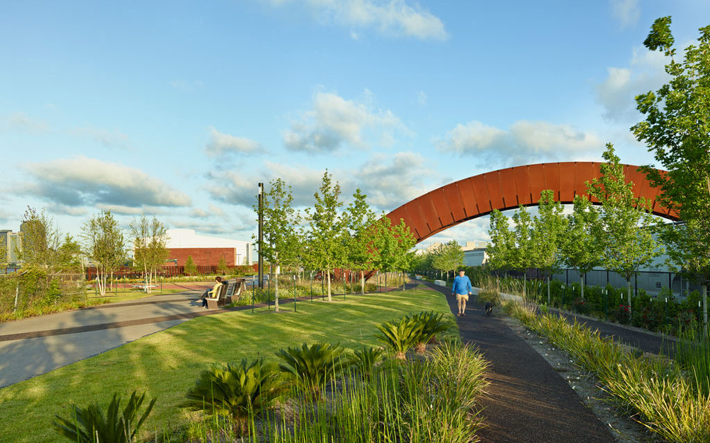
A narrow strip between box levee and rail tracks widens from five feet to thirty feet, moving downriver, allowing for a linear park of “boxcar hedges,” vegetation planted in orthogonal bands matching the scale of the adjacent railroad container cars. Grouping the vegetation bands at boxcar scale blurs the relationship of active freight to the river, while maintaining the industrial scale of the continuing activity of the rail activity. The bands of vegetation are periodically bisected by the figurative extension of the street grid to the river, physically expressed as a contrasting paving material and species, as the floodwall cannot be punctured. This extension of the street grid doubles as wayfinding for park visitors. Credit: Timothy Hursley
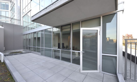
This 1.4-mile linear park includes 20-acres of indigenous landscaping, a network of paths suitable for walking, jogging, and biking; picnic areas, a dog park, and the adaptive reuse of two industrial wharves: the Piety Wharf and Mandeville Shed.
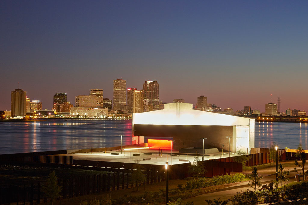
Both structures have been stabilized and repurposed to accommodate public gatherings, festivals and the host of artistic exhibitions that take place throughout the year. The architects made a conscious decision to celebrate and build upon the layers of history and character that already defined the sight.
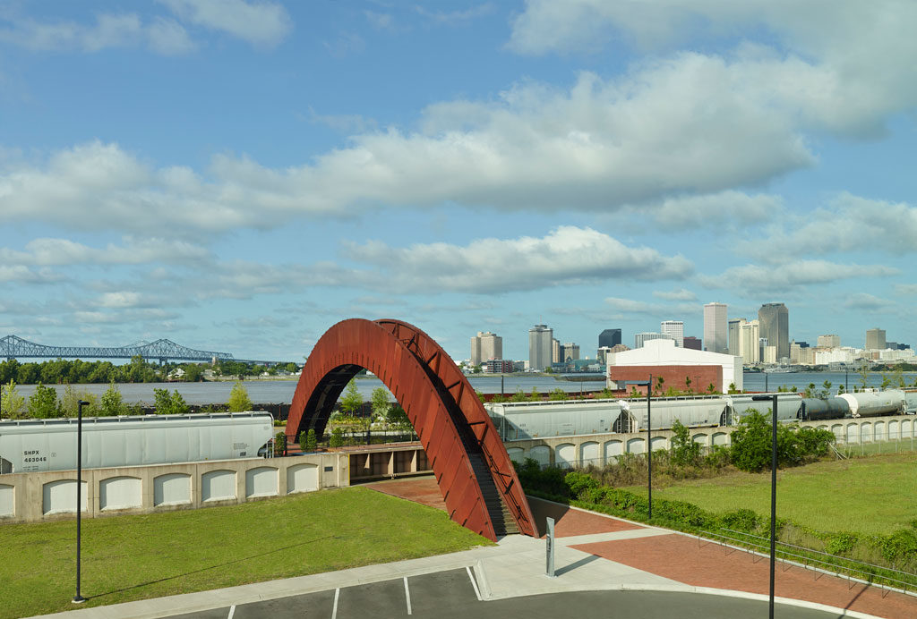
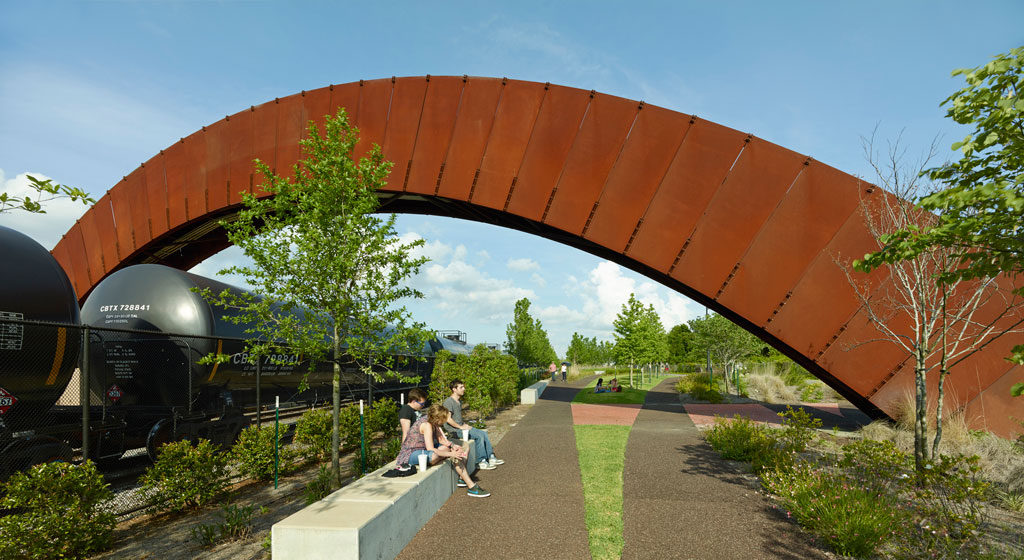
The bridge is oriented toward the remaining extent of the wharf, upon which a stage is positioned for event programming and reflection out over the Mississippi River. The firewall of the original wharf remains intact, providing the most prominent vertical landmark along this stretch of the park, providing afternoon shade to anticipated wharf gatherings and activities. Credit: Timothy Hursley
A nod to the industrial past, the repurposing of both structures is a modern reinterpretation. In place of shipping and receiving goods, these two spaces provide opportunities for engagement and interaction, the exchange of ideas and conversation.
- Inscribed lines of the defunct railroad tracks are the foundation of all the pathways in the park.
- Though still separated from the Marigny and Bywatereighborhoods via an active rail corridor and flood wall, the site identifies the intersections of the main promenade with the historic street grid. Each intersection is highlighted by a large slab of concrete bearing the street name. This acts as a means of wayfinding and orientation while inviting visitors to sit and enjoy their surroundings.
The park is first and foremost about connection: reconnecting neighbors to the river they live so tantalizingly close to, but have long been denied access to this riverfront landscape: free of vehicles, and now, largely free of structures. Given the impracticality and cost of taking on the river control structures, the team focused their efforts on making the coarse, post-industrial maritime landscape accessible to pedestrians without scrubbing away the patina of past heavy commercial port use. Native landscape far outweighs the area given to grass lawn, continuing the ever-increasing growth of vegetation over the decaying port structures and promoting a more sustainable landscape approach. Credit: Timothy Hursley
By reconnecting to the river, New Orleans is following the trend of many world-class cities and exploring opportunities to restore and enhance the natural environment while simultaneously improving citizen’s quality of life.
Eskew+Dumez+Ripple Team
Mark Ripple, Principal-in-Charge
Amanda Rivera, Project Manager
Allen Eskew, Principal-in-Charge
Project Team
Core Team
Eskew+Dumez+Ripple, Executive Architect / Architect of Record
Hargreaves Associates, Landscape Architect & Design Lead
Adjaye Associates, Design Architect (Piety Wharf & Bridge)
Michael Maltzan Associates, Design Architect (Mandeville Wharf & Bridge)
Additional Consultants
Chan Krieger Sieniewicz, Urban Design
Kulkarni Consultants, Structural Engineering
Lucien T. Vivien Jr. & Associates, MEP Engineering
St. Martin Brown & Associates, Associate Architect
Johanna Leibe & Associates, Associate Landscape Architect
Lam Partners PHA Lighting Design, Lighting Design
Urban Systems, Traffic Engineering
C.P. O’Halloran Associates Inc., Cost Estimating
Photographer
Timothy Hursley
